Michigan congressional redistricting drafts are done. Few incumbents are safe
Nov. 1: Michigan redistricting panel OKs three congressional maps; more tweaks likely
Oct. 21: Facing backlash, Michigan redistricting commissioners may adjust maps
Oct. 15: Michigan redistricting panel’s maps spark racial backlash, fairness questions
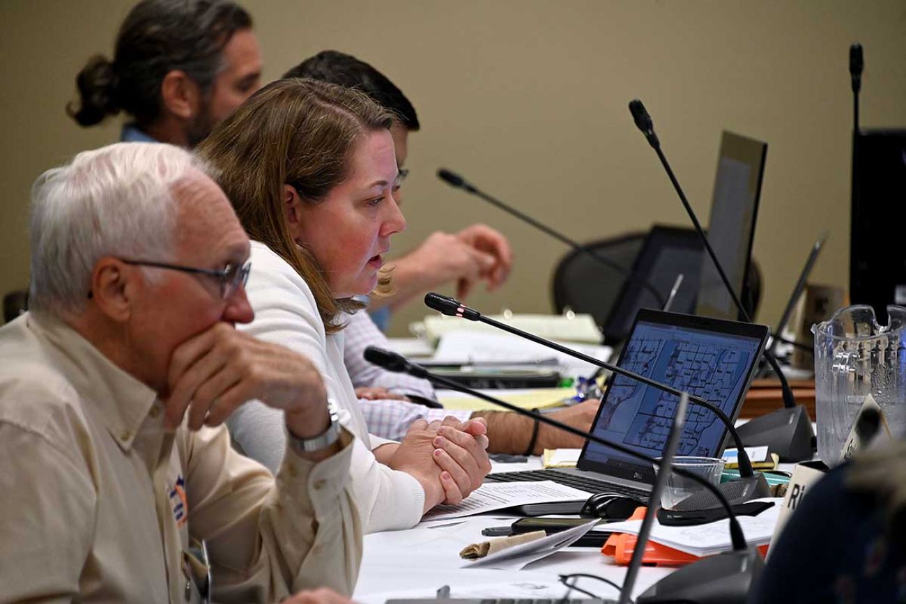
LANSING — Michigan’s redistricting panel agreed on Monday on four congressional maps that will be brought to the second round of public hearings scheduled to start next week.
Bridge Michigan analyzed the drafts and concluded that, combined with the loss of one seat in Congress because of stagnant population, Michigan’s congressional districts likely will become far more competitive regardless of which map is adopted.
Republicans and Democrats now have a 7-7 split, but most current districts are safe seats for both parties, resulting in few competitive races. The new drafts have several districts in which 8,000 or fewer votes separated Democrats and Republicans out of about 775,000 voters.
Related:
- New redistricting map would give Democrats an edge in Michigan Senate
- Republicans have edge, but Michigan House drafts include plenty of surprises
- Michigan redistricting panel’s maps prompt complaints from all sides
And perhaps most notably to voters: Few incumbents are safe, as at least eight representatives are now placed in districts with at least one other member.
In some maps, U.S. Reps. Brenda Lawrence, D-Southfield, and Andy Levin, D-Bloomfield, are in the same district, as are Bill Huizenga, R-Holland, and Fred Upton, R-St. Joseph; Lisa McClain, R-Bruce Township, and Elissa Slotkin, D-Holly; and John Moolenaar, R-Midland, and Dan Kildee, D-Flint Township.
And one draft district centered in Macomb County would have no incumbent whatsoever.
Representatives don’t have to live in districts they represent, but the disregard for incumbency — which had been a hallmark of gerrymandered maps — shows how radically redistricting has changed in Michigan.
Voters approved the 13-member Michigan Independent Redistricting Commission in 2018 after decades in which the party in power in Lansing redrew districts largely in private after the decennial census.
That resulted in districts that a federal judge panel concluded made it easier for Republicans to maintain power, even in years they received fewer votes total than Democrats in Michigan.
The maps approved Monday are the result of two months of drawing, balancing both “communities of interests” — like-minded groups of individuals including minorities — with partisan fairness and federal law.
Detroit, for instance, would keep two congressional districts, even though its population has dropped to 637,000.
While Michigan now has two districts with a majority of Black voters, that would drop to one with all maps, and be centered in Detroit. Other drafts preserve another district composed of a majority of minority voters, including Hispanics and other races.
The maps will likely change before a final vote on Dec. 31. The commission is allowing the public to weigh in on the drafts during public hearings in), Detroit (Oct. 20), Lansing (Oct. 21), Grand Rapids (Oct. 22), Gaylord (Oct. 25), and Flint (Oct. 26).
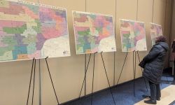
The commission has decided to rename the maps using native Michigan trees for the sake of clarity. Bridge Michigan will refer to them as such.
Bridge Michigan analyzed the maps, and here’s what we found:
Birch: Leans Democratic
This map keeps Kalamazoo and Battle Creek in two different districts, but lumps Midland in a district with Saginaw, Bay City and Flint.
According to the commission’s partisan fairness analysis, which uses a composite score of the last 13 elections in the state, this map would split the delegation 7-6 Democratic.
Congressional map (‘Birch’) proposed by Rebecca Szeleta (I) on Oct. 8
This map would give Democrats a 7-6 edge based on the 2020 presidential results, but three of the districts are incredibly close.
However, Bridge Michigan’s analysis of the 2020 election results give Republicans a majority with seven seats.
However, three districts could be considered a toss-up, with one close GOP win, and two close Democratic wins.
Apple: Toss-up
Depending on the metric you use, this map could give either party a razor-thin majority in the congressional delegation.
This proposal is the only one that has a district that stretches from Grand Rapids, all the way south to Kalamazoo and Schoolcraft, creating a solidly Democratic district.
Congressional map (‘Apple’) proposed by Dustin Witjes (D) on Oct. 5
This map breaks down 7-6 Democrat based on the 2020 presidential results. It creates a solid Democratic district connecting parts of Grand Rapids and Kalamazoo.
Source: Bridge Michigan analysis of 2020 election data based on maps provided by the Michigan Independent Citizens Redistricting Commission.
If you use 2020 election results, this map would give Democrats a 7-6 majority. However, one district would have a 521-vote margin, and another district would have a 7,300 vote difference.
Maple: Big edge for Republicans
This map covers a significant portion of the state’s west coast.
It keeps Grand Rapids and Kalamazoo in different districts. Instead, it puts Ottawa County in the same district as the city of Kalamazoo, and the city of New Buffalo in the Indiana border.
Congressional map (‘Maple’) proposed by Doug Clark (R) on Oct. 7
This map breaks down 8-5 GOP based on the 2020 Presidential results, but four districts are toss-ups, separated by less than 8,000 votes for Democrats and Republicans.
Source: Bridge Michigan analysis of 2020 election data based on maps provided by the Michigan Independent Citizens Redistricting Commission.
According to Bridge’s analysis, the map would give Republicans a three-seat edge, giving eight seats to the Republican Party and five seats to the Democratic Party. Two districts would give the GOP a close win, while two other districts would give the Democratic Party also a close win.
Juniper: Another toss-up
This map was worked together by the commission, but tweaked by Commissioner Anthony Eid, an independent.
It gives Republicans a 7-6 majority, while creating four tossup districts, Bridge Michigan found.
Congressional map (‘Juniper’) proposed by Anthony Eid (I) on Oct. 7
This map breaks down 7-6 GOP based on the 2020 presidential results but with four districts where the margin is less than 8,000 votes.
This map would put Lansing in a more compact district, sharing a representative with Clinton, Eaton, Livingston Counties, and parts of Ionia and Owosso counties.
According to the commission’s partisan fairness analysis, Democrats would hold a majority with seven seats.


See what new members are saying about why they donated to Bridge Michigan:
- “In order for this information to be accurate and unbiased it must be underwritten by its readers, not by special interests.” - Larry S.
- “Not many other media sources report on the topics Bridge does.” - Susan B.
- “Your journalism is outstanding and rare these days.” - Mark S.
If you want to ensure the future of nonpartisan, nonprofit Michigan journalism, please become a member today. You, too, will be asked why you donated and maybe we'll feature your quote next time!